''Arkadagly ýaşlar" žurnaly

The Founder-Youth Organization Of Turkmenistan Named After Magtymguly Address: Ashgabat C.,Garashsyzlyk Avenue; 104 Phone.:(993 12) 44-88-80; Fax:44-88-94 Email Address: Arkadaglyyashlar@gmail.Com

News

Cold Akpatlavuk Volcano

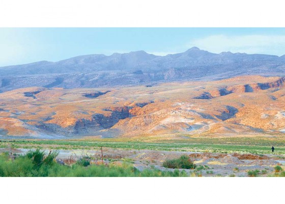
There are many fascinating places in the world that make people enchanted by the beauty and harmony of nature. Undoubtedly, one of such corners of nature is a mud volcano called Akpatlavuk, whose name is translated as White Volcano. It is located in the so-called South Caspian depression in south-western Turkmenistan, where almost half of all mud volcanoes of the world are located. There are more than 200 of them in the region, and about 30 volcanoes are located in the territory of Turkmenistan. Their number varies depending on the activity of the bowels of the earth. For example, a new mud volcano appeared in Turkmenistan’s water area of the Caspian Sea in 2017. Akpatlavuk is located between the villages of Ekerem and Esenguly in the Balkan velayat. This natural wonder is one of the highest and most active volcanoes in the region. It arouses fascination with its grandeur; its height is about 80-90 metres. The road to the volcano runs along a deserted off-road. After arriving at the foot of the mountain, we climbed its slope, where various shrubs and herbs, such as harmala, wormwood and other plants used in folk medicine grew. The scent of these herbs can be dizzying with a variety of aromas.

Ethnographic Wonders of Ayry-Baba

Rocks, wind, snow, low temperatures and oxygen deficiency make the mountain peaks difficult to reach. But despite this, people have been striving to conquer them since ancient times. Is this why mountain peaks are revered as places of patience and endurance, spirituality and holiness? For example, Mount Kailash in India, Mount Fuji, Mount Sulaiman-Too in Kyrgyzstan, Mount Khan Tengri in Tianshan on the border of three states, Kazakhstan, Kyrgyzstan and China, and Mount Ararat that Armenia and Turkey associate with their culture. Likewise, the top of the Koytendag ridge – Mount Ayry-baba is not only the highest point of those mountains and Turkmenistan (3,139 metres above sea level), but is also is a sanctuary revered by local people. When approaching the Koytendag Mountains, the summit can be seen for hundreds of kilometres away. It can be seen in snow and cumulus clouds, in fogs and under a bright sun, in any weather. Its majesty is so attractive that you cannot take your eyes off. In winter, those places are covered with snow, some niches have the ice cover ten metres thick. In summer, standing on the summit, you can admire goats and mountain rams grazing in the mountain meadows and watch the birds of prey soaring at lower altitudes. In early spring, and sometimes even in February, the rare Crocus korolkowii blooms there at the edge of the melting snow. Though there are peaks

Me­dicinal Milkvetches of the Koy­ten­dag Moun­tains

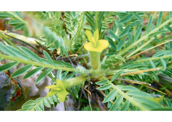
The flo­ra of Turk­me­nis­tan inclu­des about three thou­sand species, of which one-third can be found in the Koy­ten­dag Moun­tains – in gor­ges, on hills, at foot­hills and along moun­tain rivers and la­kes. Among the plants that comp­le­ment the local landscape are ama­zing milkvetches (Ast­ra­ga­lus). In dif­fe­rent parts of the count­ry, 157 species grow, 63 of them can be found in the moun­tain zo­nes of the sout­heast of the count­ry at an al­ti­tu­de of 2,500 met­res above sea level; ni­ne species are en­de­mic, for examp­le, Ast­ra­ga­lus ke­li­fi, and twen­ty ones can be att­ri­bu­ted to ra­re plants. Bio­lo­gical­ly active subs­tances found in various or­gans of the­se le­gu­mi­nous plants are cha­racte­ri­sed as me­dicinal, fod­der, or­na­men­tal, dyeing, or in­dust­rial raw ma­te­rial. High in the moun­tains, milkvetches are ra­re, they pre­fer the flat foot­hills and even the san­dy areas of the Ka­ra­kum De­sert; they are well ea­ten by lives­tock, the­re­fo­re so­me of them are used in fod­der pro­ducti­on. The­re is a ne­ed for do­mes­tication in their na­tu­ral ha­bi­tats by ad­di­tio­nal over-gras­sing. Lives­tock bree­ders app­reciate their tall­ness, pro­ductivity, high ger­mi­na­tion capacity even af­ter secon­da­ry mo­wing, re­sis­tance to adver­se environ­men­tal inf­luences, di­sea­ses and pests. A num­ber of milkvetches in so­me qua­li­ties are

Oasis around Mounts Syunt and Hasar

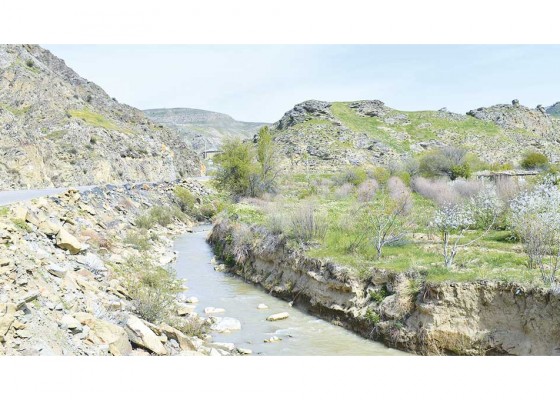
Protected by two ridges of Mounts Syunt and Hasar, the valley of the Sumbar river is a wonderful corner of nature. The endlessly long Aydere gorge, partly included in the Syunt-Hasardag State Nature Reserve of the Ministry of Agriculture and Environment Protection of Turkmenistan, stretches there. The river of the same name, repeating the bends of the canyon’s sides, has a fast and stormy current, many small waterfalls – the most beautiful one can be found in the side gorge of the Sumbar valley called Gochdemir, and also rapids, rifts, chutes and shallow areas where moisture-loving and aquatic plants cling to the walls. Walking along this wide corridor, you can imagine yourself in a botanical garden, looking at the tall elm trees, which in the East are called karagach. These fast-growing light-loving deciduous giants are able to withstand cold and heat equally well. The tree adorns both the south and the north of the country, thus attracting the attention of gardeners and ecologists. There, low trees of Acer turcomanicum coexist with thickets of barberry and wild rose, rare wild-growing trees of Malus turkmenorum and Pyrus boissieriana are hidden in the thick of the forest. The place near the water is occupied by walnut trees and white-trunked plane trees, wild grapes and lush blackberry bushes “cling” to smooth rocks, and fig and cherry plum trees have chosen the dry sides of

Parrots Live in the Parks of Ashgabat

For many decades, sparrows and ringdoves have been the habitual birds inhabiting the courtyards, public gardens and parks of Ashgabat. Each morning began with the cheerful chirping of joyous sparrows making a fuss in the courtyards and on flowerbeds and the clanging of modest, delicate ringdoves that fearfully took off frequently flapping, gained height, spreading their wings and tail, and landed thrown by Ashgabat well-wishers. When multi-storey buildings appeared in the capital, an increasing number of wild blue pigeons settled down in the attics and empty roofs of high-rise buildings. In the early 2000s, exotic common mynas. In spring and autumn, other birds can be seen in the city; they stop for rest and feeding during the flight. The desert species of avifauna can fly from the Karakum Desert to feast on flowers of the maclura and mulberry fruits. However, all these birds of the local or migratory feathered fraternity have long become familiar; their appearance, sounds of voices and habits have become easily recognisable.

In the Neighbourhood of “the Crocodiles of the Desert”

I spent my childhood up to 12 years in the desert, among salty takyrs and saxaul thickets. Nature was right in the palm of my hand – its riches, beauty and diversity were a gift for us, children, and the changeable weather of the Karakum Desert was something like a school of life and helped us grow up. The memory retained many meetings with different animals inhabiting the sandy hills, and each time it was a small, personal discovery for the boys who were always ready for new impressions and experiences. One story is about the desert monitor lizard, or zemzen in Turkmen – one of the most fascinating representatives of the fauna of Turkmenistan, an important element of natural ecosystems and a species that maintains the balance and regulates the numbers of rodents and other small animals. Nature has given it the most remarkable appearance among the inhabitants of the Karakum Desert. It is also called “the crocodile of the desert”, however in fact, it is just a large lizard with a head on a massive neck, a gaze of eyes protected by thick separate eyelids and a movable forked tongue. If you disturb the reptile, it begins to hiss menacingly and takes on a frightening look. The strong tail is its adornment and weapon.

Water is a valuable property

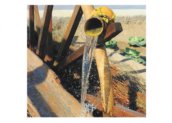
Our ancestors respected and rationally used water resources. Water is a primary necessity not only in the lives of people, but also in the lives of plants and animals. In this regard, our ancestors created numerous proverbs, such as «A drop of water is a grain of gold», «Soil is a treasure, water is a diamond», «Water decorates the earth, the swan decorates the water», «Water places are beautiful, waterless places are a desert» and we tried to observe them. This approach is due to the environmental conditions and the acute shortage of water for our people. That is why our people followed the traditions of farmers and could have a plentiful harvest with less water, could provide themselves with a normal way of life. They have gained valuable experience in the use of rainwater. Our wise forefathers, having gained valuable experience in the construction of water structures since ancient times, built such wonderful irrigation structures as the dam, jykyr, well, kariz, sardoba. They built Soltanbent, Gowshutbent in Murgap, Garribent on the Tejen River. They could water the arable land by raising the water higher with the help of dams. Our people used jykyr in the Dashoguz region and the Amuderya region to irrigate medium-sized arable land. They built a kariz to irrigate arable land in the mountainous areas of Ahal. Kariz is an underground irrigation facility made by hand, which incl

Responsible development: Nature, Economics and Technology

United by understanding the importance of a multifaceted and systemic dialogue on the development of the Caspian region, the five coastal states – Turkmenistan, Azerbaijan, Iran, Kazakhstan and Russia – are again preparing for a meeting already at the Second Caspian Economic Forum to determine further prospects for international cooperation in the Caspian region. The forum is to be held in Moscow in August this year. During two days, various discussion platforms will discuss the development of trade and economic relations among the states of the Caspian region, interaction in the fields of transport, infrastructure, energy and ecology. Cooperation with the Caspian states is one of the main priorities in the foreign policy of the President of Turkmenistan. Turkmenistan backs up important political decisions taken at the highest level with specific mutually beneficial projects that meet high international environmental standards. Historical Prologue

In the Land of Deep Canyons

Turkmenistan is the land of the most ancient civilisations, its centres of culture and agriculture of different time periods are an archaeological Klondike for the representatives of the scientific world. The very beautiful natural landscapes with a contrasting microclimate and unique nature, where ecosystems of mountains, deserts and the sea coexist, “breathe” with history. The Koytendag Mountains, a land of legends, unique natural monuments and distinctive traditions, attractive in the ecological, scientific, geological, historical, cognitive and aesthetic terms, have many notable natural attractions. The word “Koytendag” means “mountains of deep canyons”. There, the highest mountains in the country with deep lakes and long karst caves are located. The natural beauty of those places is mostly protected within the Koytendag State Natural Reserve of the Ministry of Agriculture and Environment Protection of Turkmenistan.

Saxaul Wood at Lake Zengi-Baba

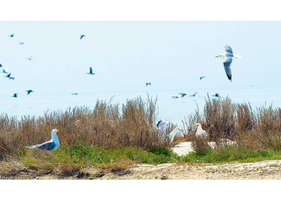
In the north of Turkmenistan, there is a kind of green-blue oasis among the desert steppes with channels and collectors connecting the lakes, around which separate ecosystems, “islands of life”, surrounded by coastal shrub vegetation, have formed. The total area of the water basin of one of the largest lakes in the country, Zengi-Baba, is 2,470 hectares, it was formed as a result of filling the depression at the north-western side of the hill of the same name with collector-drainage waters coming from the agricultural areas of the Dashoguz velayat. The maximum depth in the eastern part of the reservoir reaches 16 metres. On the northern side, the Kangakyr upland adjoins the reservoir with a chink steep descent. The southern and eastern banks are gently sloping, on their sandy areas xerophytic vegetation, black saxaul woods and wormwood communities with the participation of saltworts, grows. Besides, in some places, there is the tamarisk and camel thorn, and reeds are well developed closer to the water. There is no permanently residing population in those places; distant-pasture animal husbandry is developed to a small extent.ö

Triumph of Peace and Good

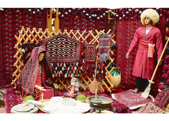
From ancient times, many peoples have associated the arrival of spring with the beginning of a new life, permeated with joy from warm days and the blessed rays of the sun that awaken nature from winter sleep, when buds swell on the branches of trees, the first flowers bloom, and everything around is covered with a green carpet. The earth is entering a magical period of renewal of nature, and people celebrate this event with a big holiday, Nowruz, wishing good, warmth and prosperity to their neighbours. Living for centuries as a symbol of peace, friendship and good neighbourliness, colourful Nowruz was awarded international status as a phenomenon strengthening relations among states and popularising the historical and cultural traditions of the peoples of the East. Every year, on the eve of spring celebrations, themed exhibitions devoted to the national holiday of Nowruz are opened at the temples of art of our country.

Koytendag – the Land of the unique beauty and sound Health

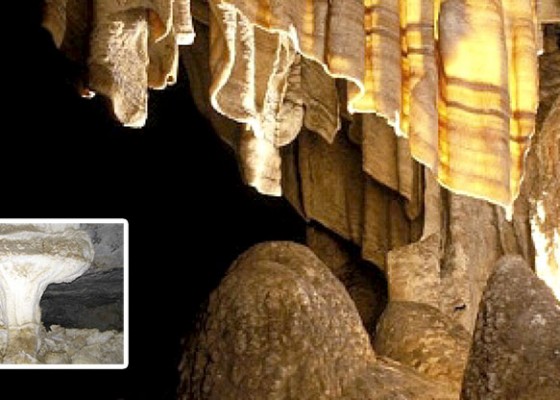
Turkmenistan is a country extremely rich in historical, cultural and natural monuments. One of the most beautiful places in our country is the Koytendag region, which attracts travelers and leisure lovers with its magnificent sites and extraordinary natural beauty. This fabulously beautiful corner of our country is known all over the world for its mysterious grottoes and caves, majestic gorges, water cascades sparkling in the sun, amazing waterfalls and healing mountain lakes, as well as unique fauna and flora. Getting into any of the gorges, lakes and caves, one can find himself in the fantastic world filled with unique beauty peculiar only to the Koytendag mountains. The caves of the Koytendag mountains, also known as Garlyk caves, including Khashimoyuk, Gulshirin, Aralik, Kepderkhana, Kapkotan, Dashyurek are very popular among tourists. These caves are famous all over the world and a visit to them leaves an unforgettable experience. As invaluable natural attractions, the Garlyk Caves are considered worthy of being included in the UNESCO World Heritage List. The underground caves of the Koytendag literally resemble the magnificent and unique palaces of the underworld. The beautiful halls, beautifully decorated with stalactites and stalagmites, are rich in beautiful forms, like in fairy tales. When light falls on magical halls covered with eternal darkness, amazing beauty aris

A Precious Gift of Nature

The complex of ecosystems of the Karakum and Kyzylkum Deserts with the exotic landscape of the arid zone and the change of unrepeatable areas of overgrown and mobile dunes, expanses of brackish, rocky, gravelly and clay-loamy soils of arid landscapes leaves an unforgettable impression. For all its seemingly unfriendliness towards travellers, this land is full of original and charming beauty. Anyone who has been there at least once, spent a night under the dome of bright stars in the steppe without electric lighting accompanying the highways and villages, will fall in love with that land forever. Such a person will be attracted by the memories of loose ridges of dunes, pink sunrise, the scorching sun of noon and a long fading sunset, brisk lizards and cheerful birdies of a bright and laced saxaul forest, fragrant herbs, night chirping sounds and a pile of saxaul coals smouldering in the night for a tea tuncha and long stories at the dastarkhan in the expedition bivouac.

Black Spots on Long Ears

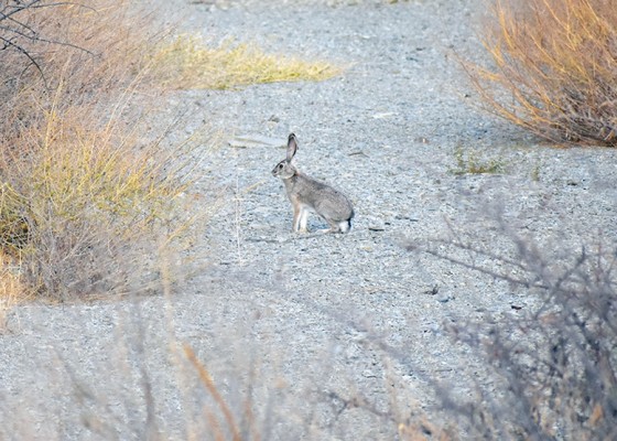
We happened to see these charming animals before – in vicinity of Lake Sarykamysh and Zengi-baba, where a hare has where to hide. All it has to do is to dive into thicket of reeds or get lost amidst the trunks and branches of saxaul. However, this time we were lucky to see a tolai hare in the mountains in the territory of the Kopetdag Nature Reserve. The hare that had met few people, not frightened by them, was in no hurry to get away. It ran past us, amongst the tall bushes of blackberries and barberries, stopped and looked around. We froze – the hare was so close that we could see it. Black spots on its ears and paws became clearly visible in scarce grass when it jumped to the side. It turned out that hares live not only in tugay, near rivers, lakes and in the Karakum Desert, but also in the middle mountain belt. Scientists find the tolai hare in the mountains at an altitude of up to 2,500 metres above sea level, and they say that it is larger than the sandy hare.

Resources of the Zengibaba Lake

We can see the Akjagaya Basin, the Mergenashan Ravine, including Zengibaba area near the Gaplanggyr Reserve in the territory of the Dashoghuz Province. They are located in the desert area in 180 km. distance from the centre of the Dashoghuz Province and in 60 km. of south-west from the Ruhubelent township, at the foot of the Shasenem State Nature Reserve. These beautiful places of nature are remarkable for their geographic location, by their unique flora and fauna. According to the legend among the people once upon a time the saint person by the name Zengibaba lived in this part of the country. He was the god of cows. Sitting on top of the hill on the bank of the lake with fresh water, around which there was abundance of green grass Zengibaba pastured cows. The seven metre long grave of Zengibaba has preserved to our times on the top of the mentioned hill. The lake situated near it is called the Zengibaba Lake. The total area of the Zengibaba Lake is equal to 2470 hectares and the volume of water is equal to 140 cubic metres. It borders on the Shasenem State Reserve. This lake was formed as a result of flow of drains in the north-west of the Zengibaba Elevation. The deepest point of it reaching 16 metres of depth is situated in the eastern part of the lake. Large and small drains joining together form the 15 km. long lake. The bushes of tamarisk and ca

A Legend of the Great Balkhan

The Great Balkhan is a mountain range in the west of Turkmenistan, in the Balkan velayat, near the south-eastern coast of the Caspian Sea. The dry river bed separates it from the Small Balkhan and the western end of the Kopetdag ridge. The highest point of the Great Balkhan is Mount Arlan. The mountains are famous in all the surroundings, and the ridge itself looks like a fortress, towering over the surrounding plains. Many legends are associated with the mountain system of the Great Balkhan. Thus, there are widespread legends about the valour of people living in the mountains, who experienced many ordeals. One of the legends says that once the Great Balkhan abounded in mountain springs, but during one of the enemy raids, the locals clogged them with felt mats. When the enemies left, people failed to make the precious water come back. There is a hope in this legend that the water will return, and the surroundings of Balkhan will again turn into a blooming oasis.